Looking for a challenging hike close to Winter Park with incredible vistas? We’ve got just the hike to get those gams burnin’ and deliver those ‘gramworthy photo ops.
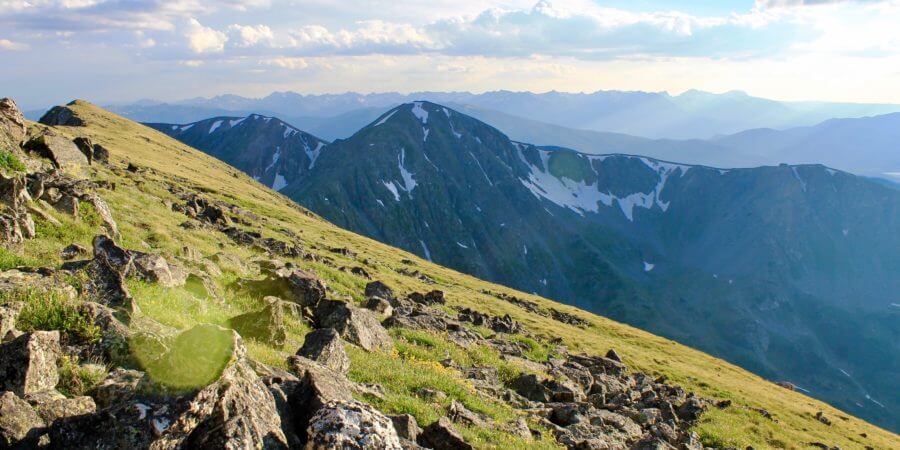
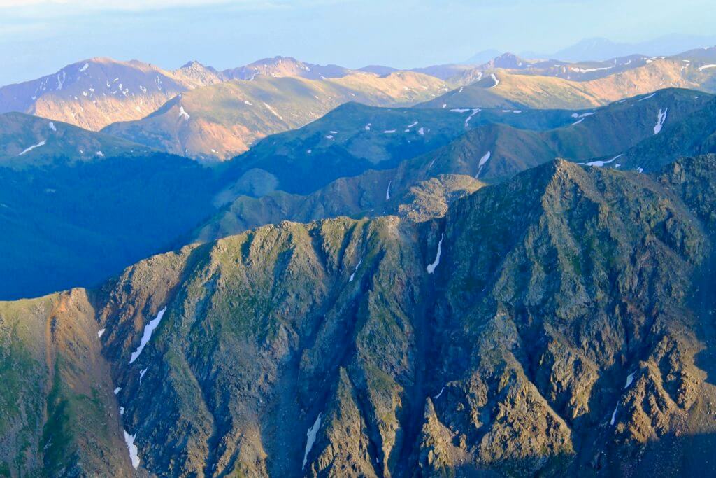
Byers Peak is an iconic mountain just west of Winter Park and Fraser that climbs to 12,804 feet. This out and back trail is about 9 miles round trip and takes you to the summit of one of the most prominent peaks in the area, offering impressive views of Grand County and beyond.
The Hike:
From the trailhead, there is about 2 miles of closed road to cover before reaching the hiking trail. Many opt to bike the road, dropping bikes at the provided bike rack before ascending on foot.
The trail then winds up through the forest for about a mile, before reaching treeline. 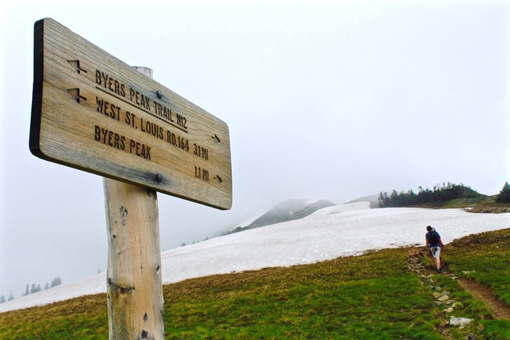 Once at treeline, the terrain gets a bit steeper, so dig deep for that final stretch and take it one switchbacked-slope at a time. This is a good time to reevaluate the sun exposure and reapply sunscreen, if necessary. Also note that winds are likely to be much stronger at this altitude, so make sure your gear is secured and you have on the right clothing layers. You might want to throw on a wind breaker or cozy fleece pullover.
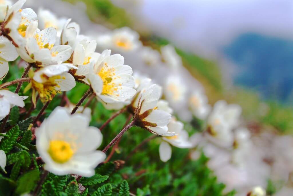
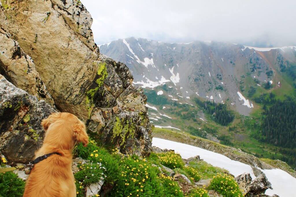
The trail follows the northeastern ridge line of Byers Peak. This portion of the trail just beyond the trees is great for checking out wildflowers in early to mid-July, so take some time to stop and smell the flowers. Snow can linger on this trail well into June, so it’s best to wait until late June or July to tackle this hike.
You will encounter one very brief section of bouldering (just two or three big reach-and-step-ups) along the way, but most hikers will be able to easily navigate this section. You’ll get fantastic views of the impressive neighboring mountain, Bill’s Peak, and sweeping grassy mountainsides.
There is one false summit before you reach the top, but don’t lose hope, you’ll be able to see the destination from there! The actual peak is marked with a stick and geological marker. Be sure to pack a snack for the top so that you can take in the view and refuel for the trek back.
This hike typically takes 4-6 hours to complete, so you should plan on making your way down from the peak before noon to avoid any afternoon thunderstorms.
Also Note:
This is a dog friendly trail, so don’t hesitate to bring your pup along for the journey!
Be on the lookout for marmots along this route—you’ll probably hear their echoing chirps long before you see these beaver-sized, squirrel-like creatures. They aren’t quiet or shy, so be sure to keep your pup on a leash to prevent any hot pursuits!
Getting There:
The Byers Peak Trailhead is only about 13 miles from downtown Fraser.
Start by turning off of Highway 40 in Fraser onto County Road 72. Take a right onto the Fraser Parkway, then turn left onto County Road 73 and continue on for the next 7 miles. You will pass the St. Louis Creek and Byers Creek Campgrounds along CR 73. Take a sharp right at the Byers Peak sign and continue on for 2 miles to the gate at the closed road and the Byers Peak Trailhead parking area. That’s where your adventure begins!
If you’re looking to take the scenic route, Byers Peak should be high on your hiking to-do list!